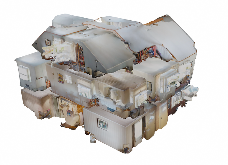
Screenshot: Point cloud data registered with the iPhone.
3. NEW ERA: SEARCHING FOR NOVELTY
During the study year 2019/2020, I worked as an intern at an architectural firm in Oslo where I got an introduction to how professional LiDAR scans can be combined with BIM models to be used in architecture. I witnessed first hand the increase in accuracy and control within the digital models, as compared to using manual measurement drawings. With the release of the iPhone 12 Pro and iPhone 12 Max in October of 2020 (Apple, 2020), I became increasingly interested in how this could make LiDAR available to the public and could open up new doors and different ways of working with architecture. Thus, begins my search for novelty.
Apple, 2020. Apple introduces iPhone 12 Pro and iPhone 12 Pro Max with 5G. Apple Newsroom. Available at: https://www.apple.com/newsroom/2020/10/apple-introduces-iphone-12-pro-and-iphone-12-pro-max-with-5g/ [Accessed April 21, 2021].
3.1 MOBILE APPLICATIONS
Mobile scanning by mobile phone uses the integrated camera on the phone together with a LiDAR sensor. According to Apple, the iPhone 12 Pro uses the LiDAR sensor to measure absolute depth (Apple, 2020). It was first developed to enhance the phone’s ability to work with Augmented Reality (AR), i.e., technology that combines real and virtual information. However, it’s sensor also makes the phone able to take greater photos by determining the distance to the object in focus.
When starting this process I tested several available mobile apps to see what they have to offer. I tested: PointCloudScan, Canvas, RoomScanLiDAR, ScandyPro, Magicplan, SiteScape, among others.
The main criteria for the test was the accuracy in scanning, and thereby the usability, but also the options available to export the scan to combine with other design softwares. Since I did not know exactly what I would be able to use the scanning for, I wanted to have as many exportation options as possible.
I ended up selecting and using an application called Polycam (Polycam, 2021) as it offered several options when scanning and had multiple exportation options, unlike some of the other applications reviewed. The application presented itself as user friendly due to its intuitive interface. Additionally, It also had the option to immediately email, publish and download the file exports from the application, which becomes essential for an efficient workflow.
Apple, 2020. Apple introduces iPhone 12 Pro and iPhone 12 Pro Max with 5G. Apple Newsroom. Available at: https://www.apple.com/newsroom/2020/10/apple-introduces-iphone-12-pro-and-iphone-12-pro-max-with-5g/ [Accessed April 21, 2021].
Polycam, Polycam - LiDAR 3D Scanner. Available at: https://poly.cam/ [Accessed April 21, 2021].
3.2 THE PROCESS OF SCANNING
As a first test I used a building that I had some knowledge of through a previous project during my study at the university. It was originally a barn built in the 1600s and there is currently a debate whether it should be preserved as cultural heritage due to its old age. There have been many attempts to measure the building using traditional manual techniques such as measuring tapes, rulers and laser measurer. The results vary greatly due to the irregularity of the building. The building is quite small and is a part of a larger square with buildings that throughout history have been restored due to fire. Despite its size, the building is quite complex to measure manually as parts of the construction has sunken due to underground movements. The building elements are also curved and twisted due to their old age. Because of the challenge, I saw it as an appropriate candidate to test the LiDAR scanner on the iPhone.
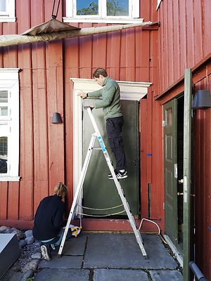
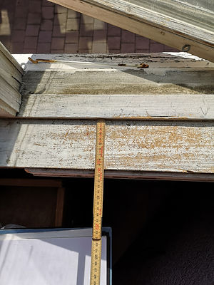
Photo: Measuring a deformed door using tape measurer.
Photo: Measuring the framework for a window in the same building
Measuring manually may be very fast and efficient and it can be preferred in many cases if it is just a quick measurement that is required. However, in the case of this building, with walls being crooked, it is difficult to know exactly where a measuring error occurs if the measurements do not add up when drawing the plan view drawing of the building. In opposition, when scanning you have reference points that work together in one coherent format. If there is an error in the scan, this is often visible. Thus, scanning in a sense leaves less to the imagination and gives wanted control over the measurements which becomes important during the drawing process.
Video: Showing the process of scanning in the old building.
In the video above you can see the process of scanning. It looks and feels very similar to filming. In terms of the actions needed it is very much the same. While scanning I started to see the elements of the building in a different light. Through the blue areas on my screen that suggested that I had not scanned the area properly, I was forced to see aspects I otherwise would not have thought to look at twice. In many ways I think surveying with the phone is so visual that as an architect with the inherent training, you are encouraged to view the whole building with all its visible elements. You are encouraged by the technology to view the architecture for what it is, rather than what you think it is.
According to Stephanie Balters, "Only those object information that enter the human system, are accessible for the subsequent reconstruction of the object within the cortex of the brain” (Balters et al., 2015, p. 7 ). Suggesting that in fact by scanning and being able to see the object once again, your brain is actively seeing objects or elements of the building that are reconstructed in your brain. Everything you see and experience can therefore be a part of the design process in a later stage. Perhaps, when observing the building, there was a specific part or element that captured the architects eye upon seeing it multiple times, thus becoming the source of inspiration for a new architectural idea. In essence this means that when observing and crosschecking with the technology, and being forced to look again, you begin to see new dimensions and elements you otherwise would not have noticed. The possibility to view more, yet being able to survey and measure at the same time offers potential in how we are able to process and capture the essence of the building.
What is important in the way scanning and measuring traditionally differs, is the way we abstract things in our mind. When in the process of measuring by hand, we familiarise ourselves with the environment and make choices of what to measure and how to measure it. Whereas with scanning, everything is just as important and the abstraction only begins after you have scanned, through for example an architectural plan view drawing. This allows for a further study of the details of the building. In many cases those details in old buildings are exactly the most unique and give character to the building.
While scanning the building, I made several scans, trying to be able to get a complete overview of the building as if I were to make changes to it later, as an architect. I focused my scanning to capture the walls towards the exterior, floor, ceiling and openings. After about half an hour of walking around the building I was done. The post-production of putting together my scans is shown in the video below.
Balters, Stephanie; Bisballe Jensen, Matilde; Steinart, Martin, 2015. PHYSIOLOGY AND SENSORIAL BASED QUANTIFICATIONOF HUMAN-OBJECT INTERACTION – THE QOSI MATRIX
. In: Proceedings of the 20th International Conference on Engineering Design (ICED15), Milan, Italy pp. 7-8
Video: Process of putting together the scans in ArchiCad.
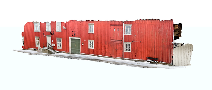
Image: Perspectival view of the west facade of the old building
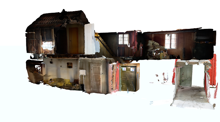
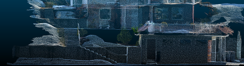
Image: 3D cross section of the scanned building.
What I realised when scanning in this way is that everything becomes very visual. In every stage of the process, from being on site to being on the computer putting together the scans, I familiarised myself with the building both in terms of the surfaces and the structure. Through the visuals I was able to see what load bearing walls needed improvement to restore life to the building which is currently unused.
What I have experienced is that scanning offers an extremely fast way to survey and register an existing building, allowing for buildings to be efficiently monitored and if necessary, worked on. The process of putting the scans together seemed to be slightly time consuming. However, during the process of my thesis, the technology and its applications have also significantly improved. The improvements are mentioned further in chapter 3.4 RENOVATION BY SCANNING. The process is not yet perfect as there might be inaccuracies in certain areas of the production of the scans. The scan, however, gives a very quick overview of the building and an exceptional start for modeling within BIM. In essence, it works as a reference drawing, only in three dimensions.
With the current data of the existing situation I asked myself, what's next? What more can be done with mobile LiDAR as an initiator for a design process?
3.3 VISUALITY BY SCANNING
Architectural visualisation has become an important aspect of the design process. It is a way for architects to visualise their projects when working on them, being able to view, reflect and discuss proposed designs. It also offers a way to communicate ideas with clients in all aspects of the process. This can be done simply through a screenshot in the BIM model, to being a visualised render of a final project done by a professional visualisation firm. Final renders are often used in the marketing of a new building or project. It has proven to be an effective way to communicate with clients and the public. Perhaps this is because people are used to seeing photos and find them more relatable than for example a plan view drawing. My assumption is that realistic renders have become popular because it offers an opportunity to view the design before the design is built. The architectural visualisation industry is projected to grow further as architecture becomes increasingly visualised through renders. "By the year 2025, it is expected that the architectural visualization demand will reach $5.72 billion. When compared to 2016, that's a nearly 500% increase” (Easy Render, 2021).
Having an interest in the field of visualisation, I realised that the exported formats obtained from a scan with the mobile phone can be translatable to be used in architectural visualisation. Previously you have seen how point clouds can be used to make BIM models to design architecture. This, on the other hand, goes straight from a scan to a situation where it can be used to visualise space.
Easy Render, Architectural Visualization, 2021. A Market that Is Going to Continue to Grow. Available at: https://www.easyrender.com/a/architectural-visualization-a-market-that-is-going-to-continue-to-grow [Accessed April 22, 2021].
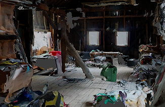
Image: Textured information shown through a Collada file, shown in Blender.
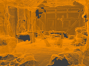
Image: Only the mesh geometry shown in the previous photo
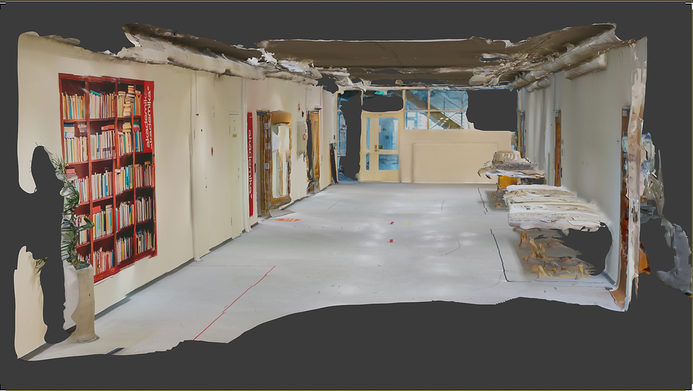
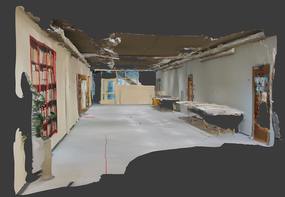
By using Polycam I had several export options in terms of the different file formats. To be able to work with visualisation I used .OBJ or .dae data which are formats that allow for objects to be made, changed and rearranged by editing object meshes. The meshes are then connected to a texture, which represents the material in real life. This texture is interchangeable and I can therefore change the surfaces, add new walls, furniture and whatever else I want to include in my rendered image. To illustrate this process I have included a scan of a hallway at the Norwegian University of Science and Technology. From here I am able to visualise what the room looks like and how it can be changed using elements of design. The work itself proves to be extremely efficient and it becomes a way to communicate a new design.
You can open the space to move around it in your browser by clicking the button "Check model here" below. When the browser has opened a new window, you can navigate around the space I have scanned by using your right and left button on the mouse, as well as scrolling to zoom. The controls are specified if you press the question mark at the bottom left-hand side of the opened page. The space is already textured by the images taken by the camera of the phone. The model works better in Safari than in Chrome.
By using the browser and being able to navigate in the scan the viewers can familiarise themselves with the space remotely and it becomes a way to learn about the space. This experience is similar to how architects are able to use BIM to assess their designs when working on the digital model. Next stage would then be for the architect to use the space as a platform to renovate, change or refurbish. As the hallway is often used to present architectural projects, I wanted to visualise how the space could change with different materials and lighting.

Images: Slideshow of a visualisation process, done in Blender.
Through the process of working like this, the architectural process of visualisation changes from being a tedious process where you first have to measure the space, make a replica of the space and then begin texturing walls, floors and otherwise things in the building. However, with scanning on the mobile phone the export formats allow you to export the space already textured. This essentially means that the scene is already set up. To get a realistic replica, the light sources in the digital models need to be placed where they are in reality.
This active form of architectural visualisation gives a lot of information for “free” and can be very cost effective. It also gives a quick way to illustrate ideas an architect or interior designer may have about a space. The only necessary tool to achieve this is for someone being on site scanning and a designer to handle the design software. To do this, I opted for a powerful and free, open-source software called Blender. “Blender is the free and open source 3D creation suite. It supports the entirety of the 3D pipeline—modeling, rigging, animation, simulation, rendering, compositing and motion tracking, video editing and 2D animation pipeline” (Blender Foundation, 2021).
Blender Foundation, 2021. About Blender. blender.org. Available at: https://www.blender.org/about/ [Accessed April 28, 2021].
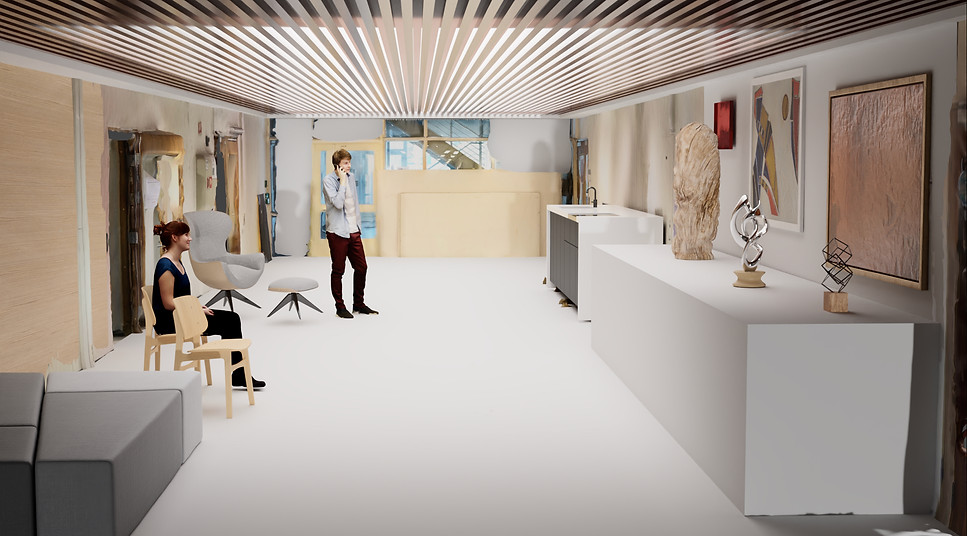
Render image: A quick sketch- render showing a possible way to redesign the space. The whole space is virtually 3 dimensions.

Render image: The same space shown with different materials and increased lighting.
Architectural visualisation has become more and more common in the field of architecture and with the technological advances out there it is important that architects pay attention to emerging technology to see how we can utilise the technology to our benefit. The design method of using the scan as the basis for a render proves to be an efficient way of working to be able to show a space and how it can be changed. With further development of the technology and the tools, the texture quality will also improve. The method that allocates the texture to registered surfaces will also improve over time, for instance by the use of better Artificial Intelligence (AI). This visualisation process can present itself as a great design process to visualise how architecture can be changed.
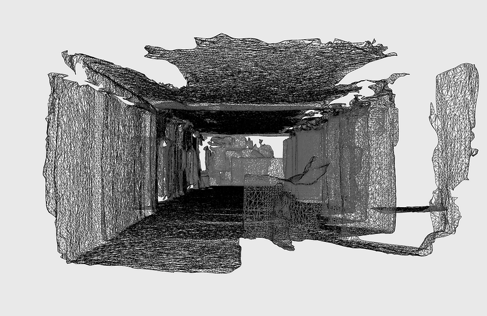
Image: An abstract way of viewing the space, only having the mesh (polygons) visible.
The spaces can also be interesting to see when abstracted without any texture. When just seeing the polygons created by the scan, we can see the raw space with the textures hidden. In time, the mesh quality will also improve as the capturing technology and software improves.
3.4 RENOVATION BY SCANNING
To further investigate and understand the potential of scanning in a design process I wanted to see if I could use it in a full-scale housing situation. If one wants to change the facade of a building in Norway you are required by law to make a building application (Byggesøknad in Norwegian). Architectural drawings before and after the change have to be a part of the application to the Planning and Building Services. The plans, facades and sections affected by a change in the design must be done by a professional (Trondheim Kommune, 2021). I wanted to test the ability to perform a full scan to create the discussed set of drawings that is required.
The application process is a part of the architectural design process and can be very time-consuming if the information about the building is limited. The building authorities normally have a building archive. In many cases the information found about the building can be limited, incorrect and/or incomplete. I tried to scan the whole house and make a BIM model of the house to be able to draw the existing situation as rapidly as possible.
While scanning, I was explaining the design process to the owner of the house. The client seemed intrigued. It was interesting to see how the owner liked seeing the house being captured on a mobile phone so efficiently.
The owner has previously had several people measure the house manually, but due to inclining ceilings, it becomes difficult to measure to standards set by technical building requirements (TEK17) in Norway, as the Gross Internal Area (GIA) also depends on the ceiling height. Due to this challenge, it seemed to be an appropriate project to test the abilities of the mobile phone LiDAR scanner.
Trondheim Kommune, 2021. Byggesak. Trondheim kommune. Available at: https://www.trondheim.kommune.no/tema/bygg-kart-og-eiendom/bygging/byggesak/#heading-h2-5 [Accessed April 28, 2021].
Video: Illustrating the process of scanning the exterior of the house.
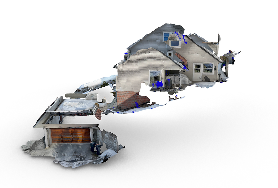
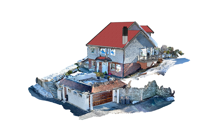
Screenshot: Exterior (South- west) part of the house. Showing the point cloud file, viewed in Blender.
Screenshot: Exterior (North- east) part of the house. Showing the point cloud file, viewed in Blender.
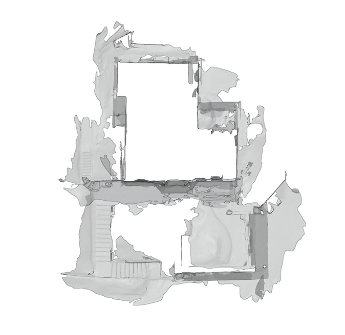
Screenshot: Site overview (top view) of the house, untextured surfaces.
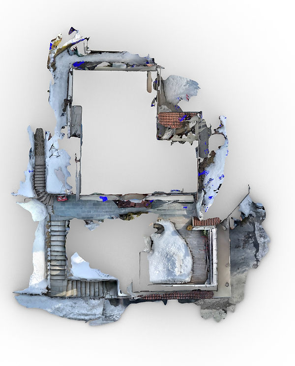
Screenshot: Site overview (top view) of the house, textured surfaces.
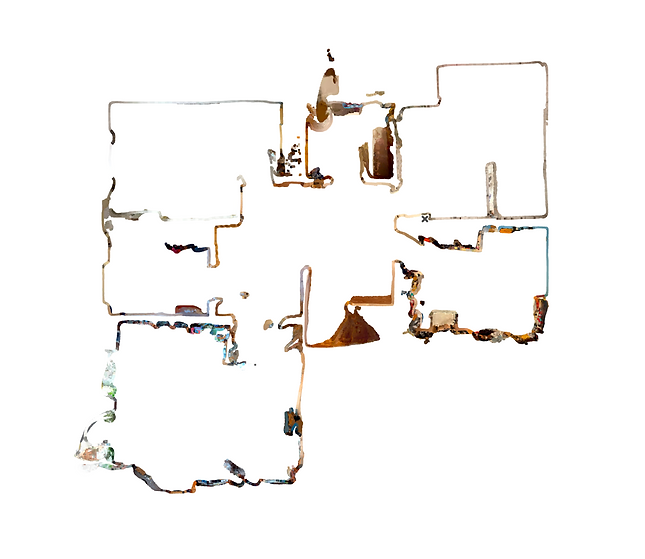
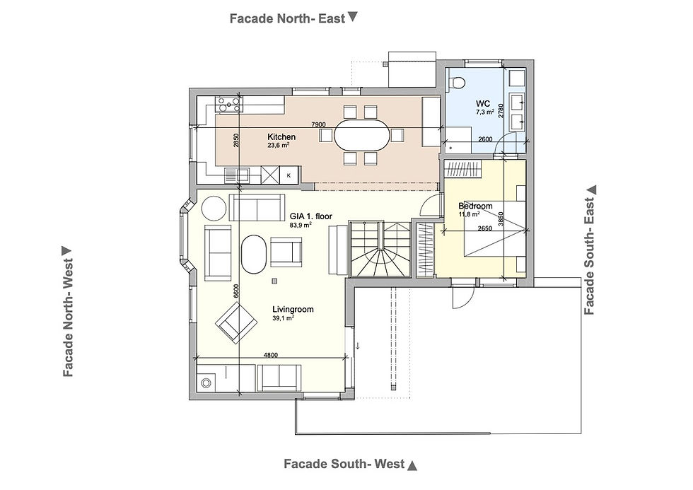
Screenshot: First floor plan (plan view) of the house, colorised surfaces.
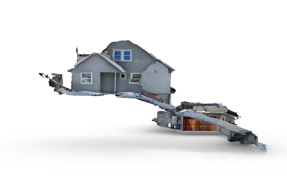
Screenshot: Model overview, textured mesh file in Blender. (Interiors are not shown due to the anonymity of the client)
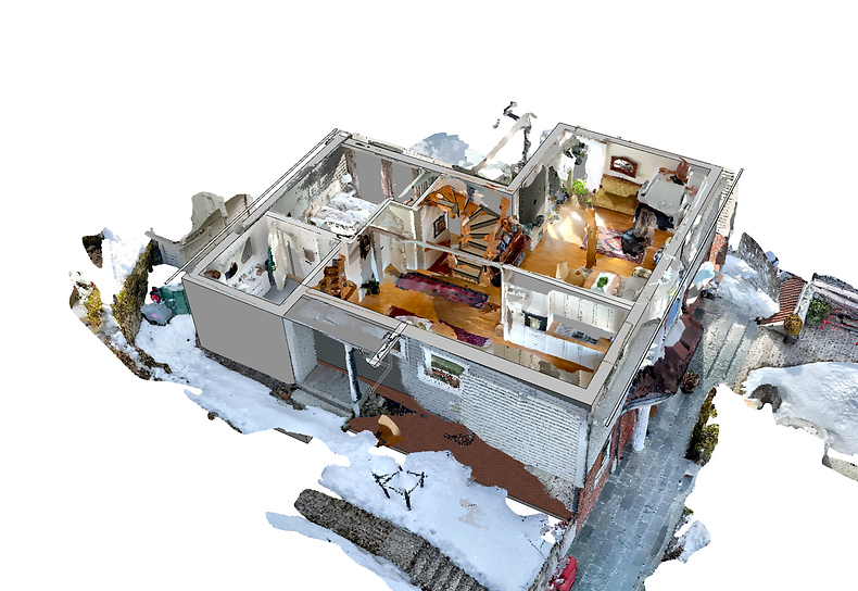
Screenshot: 3D section of the BIM file, merged with the point cloud data in ArchiCAD.
Screenshot: 3D view of the entire BIM model together with the point cloud information imported to BIM.
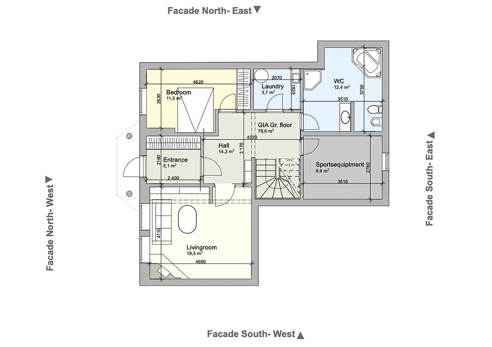

Drawings: Plan view drawings and facades extracted from the BIM file. Based on the mobile phone scans.
Similarly to chapter 3.2 PROCESS OF SCANNING, I started off by scanning the building by walking through the building. I started on the ground floor and worked my way up the building. Once I had scanned large parts of the basement I processed the scan on my phone to be able to check whether the scan was complete. In this step I could see a textured model that showed what I had scanned. I then extended the scan by pressing “extend” and included the stairs up to the first floor to be able to have a reference for the second scan. I wanted to have the three floors in separate files so that I could place these on separate layers in my BIM model. I then proceeded to make a new scan of the first and second floor, making sure that everything I had seen was included in the scan. If I observed an area that needed more information, I “extended” that particular scan to include the information I originally missed - this feature was not available when scanning in 3.2 PROCESS OF SCANNING. At the end I scanned the exterior of the house together with the garage. The process of scanning took somewhere around two hours. This time also included walking around the house, explaining the process of how I was scanning, simultaneously documenting my process and processing the scans on my phone. I also took some control measurements with a laser measuring tool to make sure the scan was accurate enough. It was important to make sure that I had included everything in my scan as this was to be the reference for the BIM model I was to make.
When I got back to my computer I imported the scans and started building the house as a BIM model. Walls, ceilings, floors, windows and doors were all modelled directly from the scan. The terrain was included in the scan of the exterior, and worked as the bases for modeling the terrain in my facade drawings. Therefore these drawings are a direct result of scanning the building on its plot. With these scans I was able to use the scans as reference in the construction of a BIM model.
To be able to further ensure greater quality and detail of the BIM model I also made a separate .dae file similar to that of chapter 3.3 VISUALITY BY SCANNING to be able to move around in a textured mesh model. I therefore had a reference photo library of the whole building available while detailing the BIM model. This was to be able to, for example, design the framing around the windows, as this level of detail can be difficult to see in a point cloud file but much easier in a textured model. I have not included this model other than the exterior view to respect the wish of the client to remain anonymous.
What became interesting about my plan view drawings in comparison to the existing drawings was how the Gross internal area (GIA) differed. The building was never originally built to plan as some measurements indicated on the original drawing were incorrect. As a curiosity, this error has resulted in the fact that the owner has payed property tax for a house that is nearly 10 square meters larger than what is the case in reality. This goes to show the importance of checking the existing drawings before making a design change.
Due to the efficiency of being able to draw the house to scale, in a BIM model, this can also open up a new dimension of how architects could work. The way we obtain information about the house can happen much faster than actually being on site. Of course being on site gives a different experience than just seeing a digital model. With a new surveying strategy, the owner of a house could with my method, scan their own house and send it to the architect who could then suggest a change using their knowledge in the field of architecture and abide by the technical laws in Norway (TEK 17). Having the experience from scanning their own house will also give an insight into how the architect’s BIM model is made. Any new designs presented by the architect will therefore be compared to the existing situation.
3.5 INTRODUCTION TO AR WITH SCANNING
Augmented Reality, most commonly known as AR, is a technology that combines real and virtual information. It can give “rich immersive experiences and allow for different environments to be transformed into responsive and personalised learning spaces” (Kerr & Lawson, 2020, p. 7 ). Mobile-driven AR is advancing rapidly and allows for an AR experience without the need for smart glasses or other equipment to be able to view AR.
To describe mobile-driven AR in a simpler way. It allows for a user to view the real world through the screen on the phone and at the same time being able to put a digital object into the real world. The combination of the real world and the placed AR object can provide a platform for learning.
As stated by Apple, the LiDAR sensor on the iPhone was originally intended to improve the Augmented Reality (AR) experience on the iPhones (Apple, 2020), as virtual objects can be placed more accurately in the real world. This is because the LiDAR measures the distance to an object in the real world and thus virtual objects can be placed correctly in the real world. An example would be if you had a virtual glass and wanted to place it on a table. To get the correct scale and, consequently, the perspective of the glass, you would have to know how far away the top of the table is from your phone to be able to place it correctly.
AR has become increasingly used in the AEC industry because of the way it can help with conveying information. As seen in chapter 3.3 VISUALITY BY SCANNING, we could have a space and redesign this on the computer. This could also be done by using AR and placing the objects in the room virtually through the phone. The result would be viewed in the space through the AR on the phone. The experience can be very interactive and you can therefore observe and learn from it.
In order to place AR objects in the real world you need to have AR objects on your phone. On the iPhone, this format is called a USDZ file. Any digital model can normally be converted to a USDZ file.
A new potential workflow therefore arises. The architectural client can scan the environment they are in with their LiDAR activated phone. This information can be sent to the architect who can then design architecture that is plot specific, regardless of where the architect is located. The client can then see how the architecture looks like on their plot.
This would allow for testing of the design in its real environment and one can see whether the design would work well or not. AR therefore offers a way to communicate, test and learn from ideas in a virtual space.
Kerr, Jeremy & Lawson, Gillian, 2020. Augmented Reality in Design Education: Landscape Architecture Studies as AR Experience. The international journal of art & design education, 39(1), pp.6–21.
Apple, 2020. Apple introduces iPhone 12 Pro and iPhone 12 Pro Max with 5G. Apple Newsroom. Available at: https://www.apple.com/newsroom/2020/10/apple-introduces-iphone-12-pro-and-iphone-12-pro-max-with-5g/ [Accessed April 21, 2021].
To set up an AR project I used the following workflow:
Step 1:
The owner or architect uses a phone to scan the site. This is done so that the architect can later use the site and design the building in terms of the existing terrain. The video underneath shows a preview of how the scanning occurs, similar to the previous chapters.
Video: Scanning the architectural plot.
Step 2:
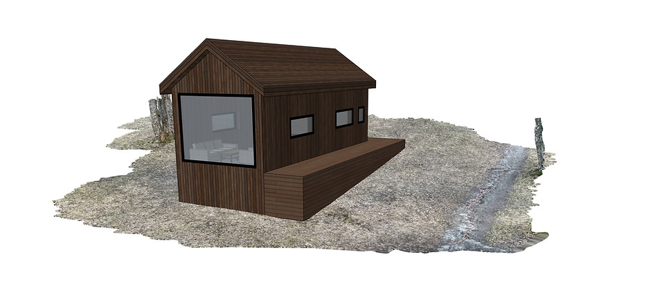
When the scan is complete, the scan is used by the architect to have a representation of the building plot. The architect then use the information in the scan, such as the GPS coordinates and the measurements of the site to be able to design a new building that is site-specific. To do this step I used the BIM software called ArchiCAD. The building concept I designed and used is just an example to illustrate the design process, with no intended focus on the actual design nor the technical requirements required in the design of a building. The design is for illustration purposes only.
Step 3:
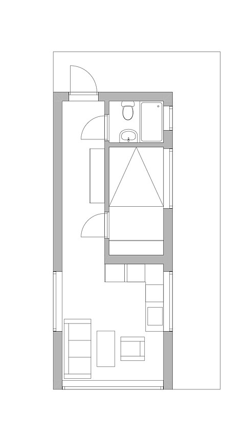
Drawing: Plan view drawing of the proposed design (illustrative).
The architects can design and test out the design of a new building in their BIM software. Together with the point cloud of the site, created by the owner, the architect can utilise the knowledge of their site to design a site-appropriate proposal. This means that architects from all over the world can partake in the design of the new project.
Screenshot: 3D view of the BIM model with point cloud data from the architectural plot.
Step 4:
When the architect feels the design is correct, in addition to plans, facades and sections, the owner of the site can receive a USDZ (native iPhone AR) file. The owner can then open the design as an AR object on the phone. As ArchiCAD currently does not have a native AR-file export, I had to discover a way to do this. It resulted in exporting the file from ArchiCAD as a .dae file. Importing it to Blender and after removing the window mesh, as window textures are not currently supported in .USDZ format, I exported the file as a .gltf. With this file I could then use the beta application from Apple called Reality Converter to convert the 3D file to a .USDZ file format. Although the process has many steps, the process is done rapidly. I am sure that BIM softwares will support AR-object export in the future as the potential and use of AR is becoming increasingly widespread.
Screen recording: Showing how the AR file can be viewed virtually through the phone.
Step 5:
Once the .USDZ file is received either by text message, email or other file exchange, the client can take his or her time to view the whole design in its intended location. They can view whether the angle of the project should be changed, whether the building needs to be bigger or if the rooms seem too small. In essence this gives the user the ability to observe how the final design would look like and they can notify if there are changes they want to be made on the design proposal. This way of using technology could prove to be very cost effective and material conservative as no materials have been spent. It would also allow for people to take part in the viewing of the building. For example, when applied to a larger scale, the city authorities could place a QR-code to an AR file next to a building site for people to view the proposed design with their own eyes.

Screenshot: Illustrating how the internals of the proposed design can be viewed.
Depending on the site, the owners will also be able to capture the views internally in their building, being able to see whether they want larger or smaller windows for example. In this pilot project the house was viewed and moved slightly further up the hill to be able to have a longer distance to the road ahead.
3.6 CHANGES IN WORKFLOW
A process involving mobile phone LiDAR scanning can enable a more interactive design process where the client can take part in the process from the start. That is, at least compared to a more traditional process. There is now a possibility where the client can be the one scanning the house in need of change, sending it over to architects for them to find a new design solution.
Being able to have a scan of the existing situation can also open up for new ways of hiring architects. The client could, with the existing situation, present a design problem he or she wants to re-design and architects can apply for the job with a design solution. The dynamic shift towards a technological approach could open doors for smaller architectural firms to be able to work globally and specialise in a certain type of context. They would most likely work in a different scale than what larger firms are able to, but can be able to excel in the way they are able to design.
LiDAR technology can also be used in As-built monitoring. The mobile phone and LiDAR can actively be a part in the construction of the project where builders or visitors of the site can scan using their phones to get both dimensional and visual data that can then be linked to the BIM model. This allows for an overview of changes or state of revision in terms of the construction process. For example, in the BIM model I would then be able to know what was constructed from one week to another. This is done by linking the scan to the appropriate section of the BIM model. This is currently possible in professional scans through real time kinematic positioning (RTK) such as through Global Positioning System, commonly known as GPS (Stal et al., 2011). In turn this could increase efficiency by having more control over the building process and, additionally, make sure that less mistakes are made, and if the mistakes are made, they are caught early on in the construction process. Essentially this becomes an accessible alternative to professional As-Built monitoring.
What is important to understand with the use of mobile phone scanning is the scale of a project in which the mobile phone becomes applicable. It will also most definitely be determined by the financial aspects of the projects. In projects with a smaller budget, the mobile phone could be applicable. It can also be applicable in larger projects if people can work together to scan several areas of the building and then later put the scans together as an overall representative scan of the building.
I believe that the idea of several people working together to be able to gather the data necessary for change can be something that would be applicable in terms of the way many large buildings are organised today. In Norway, there are many housing associations (Borettslag in Norwegian) that lack funding, resulting in facades and apartments decaying over time. Crowdsourcing could be an affordable way to be able to survey the building efficiently, piece by piece instead of getting professional help. This relates to crowdsourcing as mentioned in 4.4 EVOLVING ARCHITECTURE AS A DISCIPLINE.
Stal, Cornelis, Nuttens, Timothy, Bourgeois, Jean, Carlier, Leen, De Maeyer, Philippe, De Wulf, Alain, 2011. Accuracy assessment of a LiDAR Digital Terrain Model by using RTK GPS and total station. EARSeL eProceedings, Volume 10, Issue 8, pp. 1-8
3.7 SUMMARY
-
LiDAR was made available on the iPhones in October 2020, allowing for scanning with the use of third-party mobile applications.
-
The process of working with LiDAR on the phone is currently an undiscovered process.
-
Scanning with the mobile phone using LiDAR allows for detailed surveying of a building regardless of its shape or form.
-
The exported file formats through Polycam can be used for many different architectural processes. It makes it faster to make architectural renders and to visualise architecture.
-
The workflow allows a fast reference of the existing building that may lead to making building application drawings more efficiently due to the translatability into BIM modeling.
-
The LiDAR sensor allows for better AR experiences which can be a breakthrough in terms of how we present and critique architectural ideas before they are built, avoiding re-working and re-building.
-
The new accessibility of LiDAR can change how we interact and work as architects through how we obtain information about projects to how we present architectural designs.